
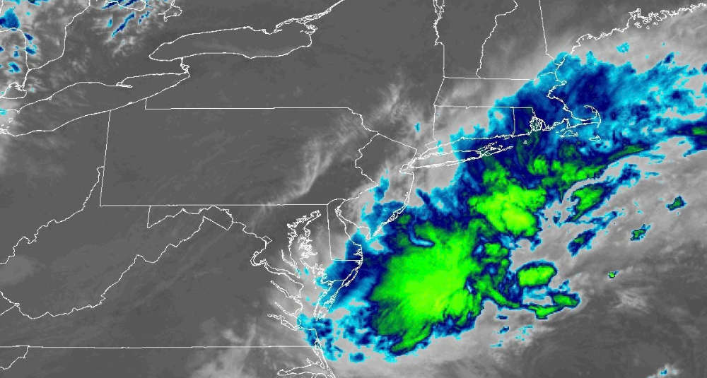
A powerful storm is moving up the east coast, what can we expect?
Update 5:11pm: The National Weather Service has updated it's prediction for rain totals in the Capital Region, with most areas seeing .5"-1", while parts of Columbia and Greene counties may see closer to 2"-3".
The nor'easter is approaching! 🌀 Periods of rain & gusty winds will continue through Monday, with the highest totals expected across the eastern Catskills, Hudson Valley, & southwestern New England. This is a long duration event, so flooding from rainfall is not anticipated. 🌧️ pic.twitter.com/IxjkZQ9pmi
— NWS Albany (@NWSAlbany) September 25, 2026
A strong weather event has been battering parts of coastal states like North Carolina and is gaining strength as it moves north. The National Weather Service in New York City has issued a number of warnings for coastal New Jersey, New York City, Long Island, Connecticut and parts of the lower Hudson Valley.
It won't be as severe for the Capital Region, though we are expected to get our share of rain and gusty winds. Friday night, gusts may reach 22mph, while on Saturday increasing to 33mph.
A Nor'easter will bring strong gusty winds to eastern NY and western New England late this afternoon into early Sunday morning. A Wind Advisory has been issued for Litchfield County, CT for winds gusts 40-50 mph. Wind gusts of 25-40 mph will be common across much of the region. pic.twitter.com/6jCQ73IULM
— NWS Albany (@NWSAlbany) September 25, 2026
When it comes to rain, it's expected to move in Saturday morning and continue through late morning on Monday - an inch or more is possible with higher totals to the south and east.
 Demolition Of The Central Warehouse Should Be Complete Next Year
 State Police Search for Armed Man in Poestenkill
 Still Have a Landline? Verizon Is Making a Major Change
 National Cheeseburger Day Deals
 One of the Strongest People in the World is a Shen Student!